Kuzzle Hypervision
Manage mobility and parking across your territory

Mobility is at the heart of local public policy: mobility plans, tackling congestion and road safety, developing active mobility, regulating parking.
Yet most planning decisions still rely on one-off surveys that give a static snapshot of flows that are, by nature, highly variable.
Sensors and IoT now make it possible to monitor these flows continuously. The challenge then shifts to the data: radars, cameras, inductive loops, parking sensors and partner data produce heterogeneous formats that are rarely cross-referenced.
This is precisely the role of the Kuzzle platform: collecting, normalising and cross-referencing these sources to turn raw flows into planning and regulation decisions.
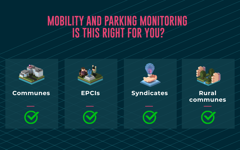
Every local authority, at every scale
From the rural town looking to make its roads safer to the metropolis regulating its traffic in real time, every territory has flows to measure and manage.
They trust us
Kuzzle’s IoT, Data, and Hypervision platform addresses Smart City, Smart Building, Smart Industry, Smart Logistics & Transport, and Connected Healthcare use cases, as well as large-scale IoT data processing.










Data-driven planning decisions and real-time regulation
Measuring continuously means replacing intuition with data: reliable counts to prioritise investments, a cross-cutting view of all flows to assess each mobility policy, and data shared in real time to inform users and regulate traffic.

Data-driven mobility policies
Building a cycle lane, pedestrianising a street, resizing a car park: these structuring decisions deserve better than a one-off measurement. Continuous counting of vehicles, pedestrians and bicycles provides reliable, seasonal footfall data that can be compared over time. Identifying and modelling long-term trends becomes a powerful decision-making tool to adapt your territory to mobility needs.

A consolidated, cross-cutting view of all mobility
Road traffic, active mobility, parking, vehicle fleets: these flows constantly intersect across the territory, yet they are usually measured in silos, by different tools and providers. By bringing them together on a single platform, Kuzzle links the actual use of infrastructure with traffic and parking data, and assesses the impact of each public mobility policy as a whole.

Dynamic data shared in real time
Once federated, normalised and structured on the Kuzzle platform, your mobility data can be delivered in different forms to inform users and regulate traffic: control of variable message signs, link with traffic lights, open data for navigation apps. A tangible, visible impact for staff and residents alike.
Turn your counting data into decisions
The whole challenge of mobility management lies in heterogeneous data formats and the many flows that weigh on decision-making. Road sensors, third-party traffic data, road network reference data, parking systems: everything must converge into a single reference base to be usable.
Structure your road and infrastructure reference base
The first step is to harmonise the territory’s existing data: road network reference data (GIS), inventory of cycling and pedestrian infrastructure, car parks, third-party or partner traffic data (navigation providers, infrastructure managers), and current mobility plans. This reference base is what makes it possible to link each measurement to the right road, the right lane, the right facility.
Kuzzle structures this reference base and puts counts into context with road characteristics and local events.

Count continuously with sensors
Traffic radars, inductive loops, counting cameras, infrared sensors for bicycles, vehicle presence sensors for parking, road surface temperature sensors: the mobility measurement ecosystem is rich and protocols vary (LoRaWAN, cellular, fibre…).
Kuzzle normalises, historises and quality-checks these heterogeneous flows, monitors sensor connectivity and links each data point to the right road section or parking space, ensuring reliable counts over the long term.
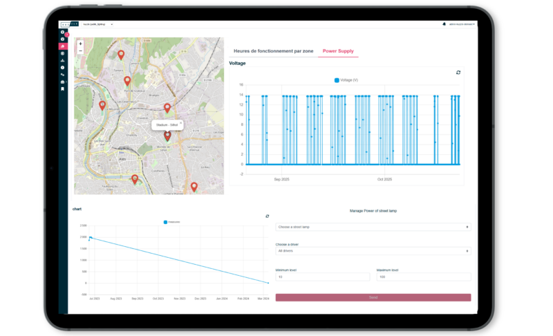
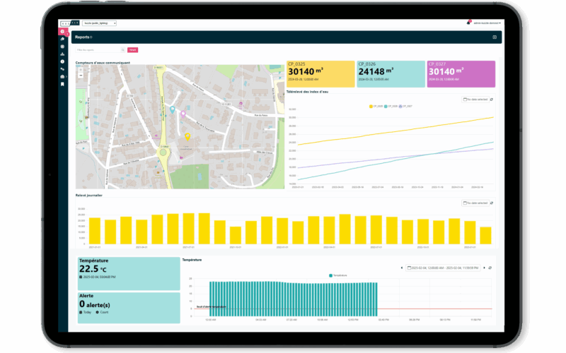
Cross-reference, analyse and decide from a single platform
Measuring traffic is not “just” a matter of counting. Cross-referencing speed and vehicle type data with weather data and local events, detecting footfall peaks on cycling infrastructure, anticipating long-term trends with AI features, triggering regulation scenarios on dynamic lanes: each of these steps calls for a hypervision platform that empowers staff and informs elected officials’ decisions.
Let’s discuss your business challenges together!
At Kuzzle, every project starts with a conversation.
We take the time to understand your objectives, your constraints in the field, and your business priorities.
What makes the difference? A dedicated team that supports you from the initial question to the scaling-up phase.
Our experts help you clarify your priorities, identify your most impactful use cases, and structure your projects with complete confidence.
Your challenges are unique. Let’s discuss them together.
Measure and analyse all mobility across your territory
Compared with a conventional business application, a hypervision platform covers all mobility flows and contextual data in a single tool, cross-referencing information to inform every planning and regulation decision.
Road traffic monitoring
Analyse road usage with traffic, speed and vehicle type data, cross-referenced with your road network and event data.
Kuzzle tracks traffic trends over time, identifies congested roads at peak hours, measures the impact of infrastructure changes (roundabouts, 30 km/h zones, dynamic lanes) and provides objective grounds for transport policy decisions.
Active mobility counting
Measure the actual use of dedicated infrastructure and the distribution of pedestrian and cyclist flows across your territory, rather than relying on one-off surveys that give a static snapshot.
Continuous counts make it possible to assess seasonal use of cycle lanes and pedestrian areas, prioritise future developments and justify investments to elected officials and users.
Smart parking
Improve turnover and make it easier to find available spaces by measuring space occupancy.
Beyond counting, Kuzzle identifies high-turnover or saturated areas, supports pricing decisions and guides drivers to available car parks, and measures the impact of parking policies on town-centre traffic.
Road surface condition monitoring
Detect weather-related risks (ice, frost heave) and anticipate maintenance on the network.
Road surface temperature sensors and continuous measurements make it possible to launch gritting operations at the right time, track interventions and prioritise network maintenance based on its actual condition rather than a fixed schedule.
Vehicle fleet management
Monitor the use of your vehicle fleet to right-size it to actual needs and anticipate maintenance.
Continuous monitoring of municipal or shared fleets (mileage, usage, availability) identifies under-used vehicles, sizes the fleet accurately and feeds local mobility data into the fleet transition strategy (electric vehicles, car sharing).
Quay slot management & port flows
Optimise river or sea port flows by tracking vessels, vehicles and containers. Quay slots, booked for loading or unloading, benefit from continuous monitoring: turnaround tracking, traceability of quay use, detection of missed or overrun slots. Kuzzle hypervision brings heterogeneous data together and provides indicators and reports tailored to port staff and operators.
Common mistakes in mobility monitoring projects
Measuring flows is one thing; turning them into a decision-making tool is another. Sensor placement, count reliability, adoption by staff: here are the key mistakes to avoid for a successful mobility project.

Relying on one-off measurements
Mobility flows vary widely with seasons, weather, events and time of day: a one-off survey can give a picture far removed from reality. Major planning decisions (pedestrianisation, cycle lanes, car parks) require continuous footfall data that can be compared over time.
A count over a single week can neither justify an investment nor assess its impact once delivered.

Choosing a counting technology unsuited to the flow
Inductive loops, radars, cameras, infrared or magnetic sensors: each technology has its own field of relevance. A loop designed for cars detects bicycles poorly, some sensors confuse bicycles with e-scooters, and a camera raises GDPR issues where a simple count would suffice.
Choosing the sensor according to the flow to be measured, the accuracy required and on-street installation constraints avoids unusable data and extra costs when scaling up.

Neglecting the quality of counting data
Counting sensors are exposed: bad weather, dirt, malfunctions, roadworks. Without consistency checks, outliers or gaps in the data series distort trends, and therefore decisions.
Detecting outliers, handling missing data and monitoring sensor health are essential to ensure reliable counts over the long term. The Kuzzle platform includes these data quality mechanisms natively.

Analysing counts out of context
Measuring flows without linking them to the road network reference data or infrastructure gives figures without context: an increase in cycling may come from a new cycle lane, a seasonal event or a diversion route.
Cross-referencing counts with infrastructure reference data, weather data and the local events calendar is essential to interpret trends correctly and assess the real impact of each mobility policy.

Underestimating the political dimension of mobility data
Mobility data such as traffic, speed or parking occupancy is politically sensitive: it measures the use of public space and can be used to support or challenge contested decisions. Data sharing arrangements (open data, distribution to elected officials, communication), GDPR anonymisation and access governance must be defined upfront.
Deploying the Kuzzle platform, with profiles tailored to each stakeholder, secures this governance.

Leaving your mobility data with your providers
Counts outsourced to a consultancy, parking delegated to an operator, sensors installed by an integrator: in mobility projects, data is often produced and hosted by third parties, on their own tools.
When a parking concession or counting contract ends, the local authority risks losing years of history, and with it the ability to compare before and after a development. Setting out data ownership, format and handover in the contracts from the start, then centralising the data on an open platform with an Open Source core, guarantees its reversibility, in line with the EU Data Act, applicable since September 2025.
Our latest success stories

Smart City
Smart Building Management
The Côte-d’Or Department (21) deployed, in record time, a demonstrator for the monitoring and automation of public buildings

Smart City
Territorial Hypervision
Development of a hypervision platform for monitoring air quality and electricity for the SIEA.
Smart City
Territorial hypervision platform
Real-time hypervisor for managing air quality and energy consumption in the Alès conurbation.
Expert support, clear indicators, measurable ROI.
At Kuzzle, we offer more than just a platform: we support you at every stage of your project, from defining your use cases to operational implementation and scaling up.
This approach guarantees you a solution that is truly tailored to your business challenges, capable of leveraging your data, streamlining your processes and producing concrete results.
Tailor-made support, closely aligned with your business realities.